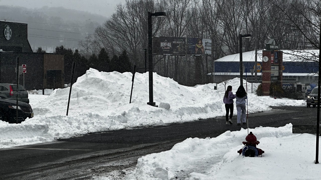
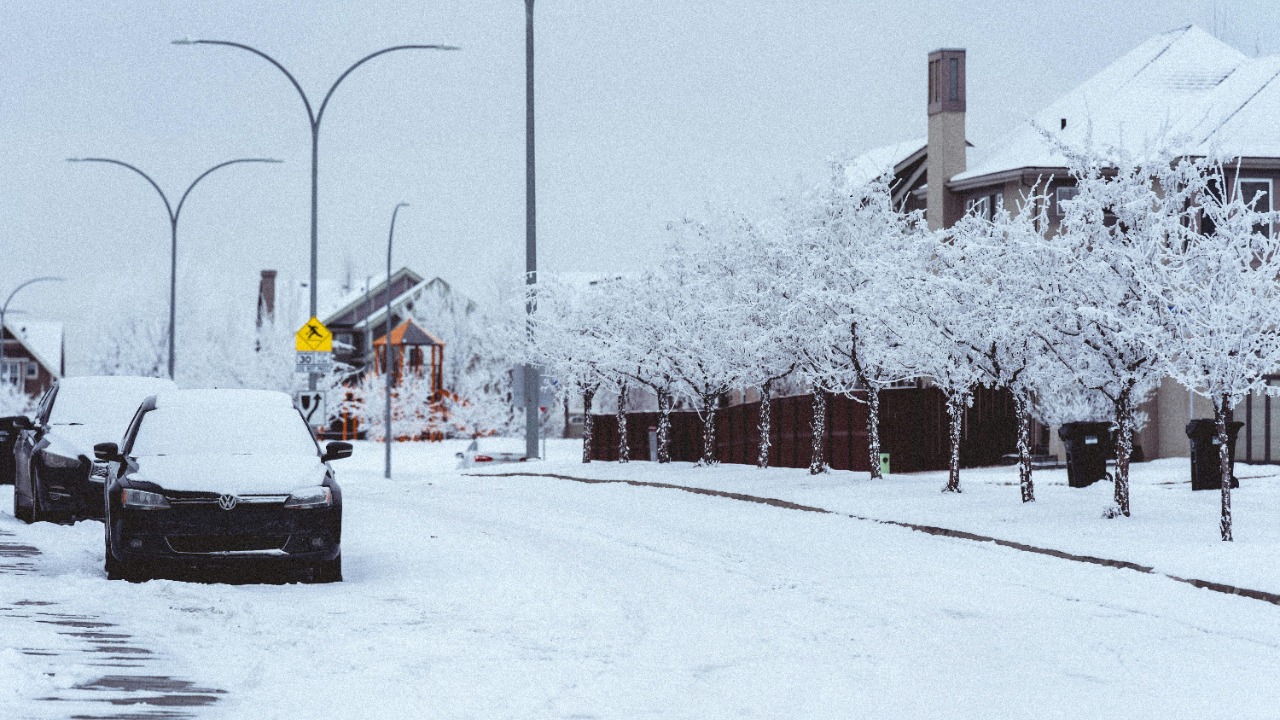
North Texas is heading into a winter stretch that officials are treating as more than a routine cold snap. Forecasters are warning that Winter Storm Fern could bring a messy sequence of freezing rain, sleet and snow across the Dallas-Fort Worth area, with the worst travel conditions expected as temperatures plunge below freezing and stay there for days. Snow alone is rarely the biggest problem in North Texas. The larger threat is often the ice that forms first on bridges, overpasses, side streets and power lines, then gets covered by sleet or snow. By the time the region reaches the back half of the weekend, residents may be looking at roads that appear passable but are still slick underneath, along with a cold spell that could keep hazards in place well after the precipitation eases.
How the storm is expected to unfold over North Texas
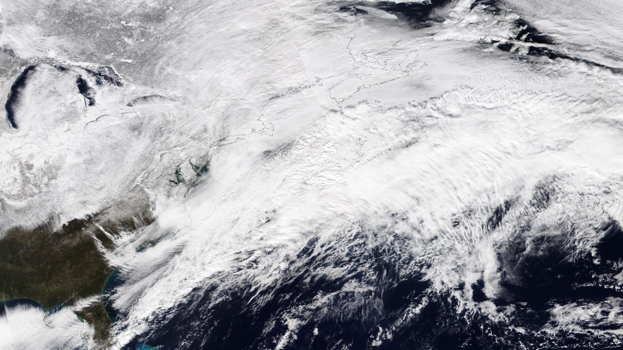
According to the National Weather Service forecast discussion for Fort Worth, the main concern is not just whether North Texas sees snow, but how precipitation changes as colder air deepens near the surface. Meteorologists warned of widespread travel impacts and signaled that dangerous cold could linger into Monday and even Tuesday in some areas, which is a critical detail for a region where roads can stay frozen long after the sky clears. Statewide reporting based on National Weather Service guidance has pointed to freezing rain and sleet developing across Dallas-Fort Worth on Friday night, with some areas potentially transitioning to snow later in the weekend.
Communities north of the Metroplex are expected to have the best chance at heavier snow, but for Dallas, Fort Worth, Arlington, Plano and surrounding suburbs, the more immediate threat is the icy mix that can make even short trips risky. The reason that matters so much in North Texas is simple. As the National Weather Service’s winter weather guidance for the region explains, freezing rain and sleet often create more severe impacts here than snowfall does. A thin glaze can shut down elevated roadways, bring down tree limbs, and snarl commutes long before dramatic snowfall totals ever materialize. In a sprawling region built around driving, that makes Fern a high-impact storm even without blockbuster snow numbers inside the urban core.
Why officials are treating Fern as a serious event

Texas moved early. Governor Greg Abbott announced on January 22 that the state had issued a disaster declaration for 134 counties ahead of the storm and raised the State Operations Center to Level II, an escalated response posture. The governor also urged Texans to stay off the roads unless travel is absolutely necessary and said the state was positioning resources before conditions deteriorated.
That declaration helped clear the way for faster emergency coordination, including a Department of Public Safety waiver for commercial drivers hauling essentials such as propane and groceries. For North Texas, where a hard freeze can turn a weekend weather event into a supply-chain problem by early next week, that kind of pre-storm action matters almost as much as the forecast itself. Local governments have been preparing as well. Dallas officials warned residents earlier in the week to stay home if possible once ice begins forming, and the city said it would open an emergency shelter at Fair Park as temperatures dropped.
Roads and flights are already feeling the storm’s effects
The Texas Department of Transportation began talking in unusually blunt terms before the full brunt of the storm arrived. In its January 23 update, TxDOT said crews were positioned across the state, that nearly 1.7 million gallons of brine had already been used, and that up to 5,000 workers were expected to respond. That kind of pretreatment can buy time on major routes, but it does not eliminate the danger once freezing rain starts sticking. Bridges and overpasses will be the first trouble spots, and North Texas has no shortage of them.
Multi-level interchanges around Dallas and Fort Worth can become chokepoints fast when a thin ice layer develops, which is why officials routinely urge residents not to test the roads just because precipitation looks light. For this storm, that warning carries extra weight because the most hazardous conditions may arrive before roads look fully snow-covered. Air travel is already being disrupted ahead of the weekend push. KERA reported nearly 1,500 cancellations across DFW International Airport and Dallas Love Field for Friday and the weekend, with airport officials preparing for icy runways and possible stranded passengers. For a region anchored by one of the nation’s busiest airline hubs, that early wave of cancellations is a sign that Fern is already rippling beyond highways and neighborhood streets.
The grid is on watch, but not yet in emergency mode
Texas energy officials are also watching the storm closely, though the picture on January 23 is more cautious than alarmist. ERCOT issued a Weather Watch for January 24 through January 27 because of forecast below-freezing temperatures, possible frozen precipitation, higher demand and the potential for lower reserves. The watch lines up with the coldest part of the forecast and keeps the focus on a question Texans never fully ignore in winter: whether the electric system can handle several days of elevated heating demand. State officials have emphasized preparation and confidence rather than panic, but the real test will come if ice-driven local outages begin stacking up while temperatures remain below freezing.
What North Texas should expect through the early part of next week
The cleanest way to understand Winter Storm Fern is to think of it as a two-part threat. First comes the precipitation, led by freezing rain and sleet, with snow possible as colder air deepens. Then comes the longer tail of the storm: the freeze that can keep roads dangerous, delay flights, strain shelters and extend power concerns after the heaviest precipitation ends. For North Texas, that means the headline is not really about snow totals. It is about duration, timing and ice. If forecasts hold, the Dallas-Fort Worth area will spend the next several days dealing with a storm capable of slowing the region before the weekend is out, and with cold stubborn enough to keep the disruption alive through January 27.


