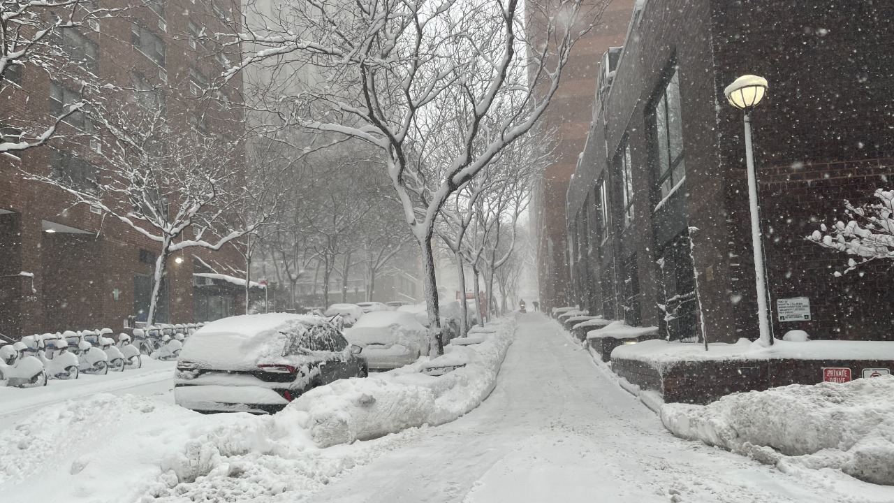
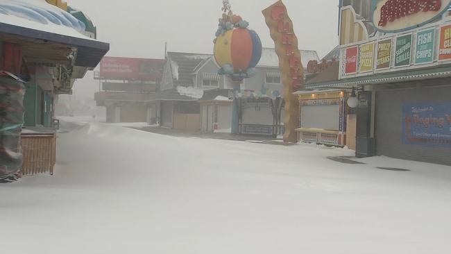
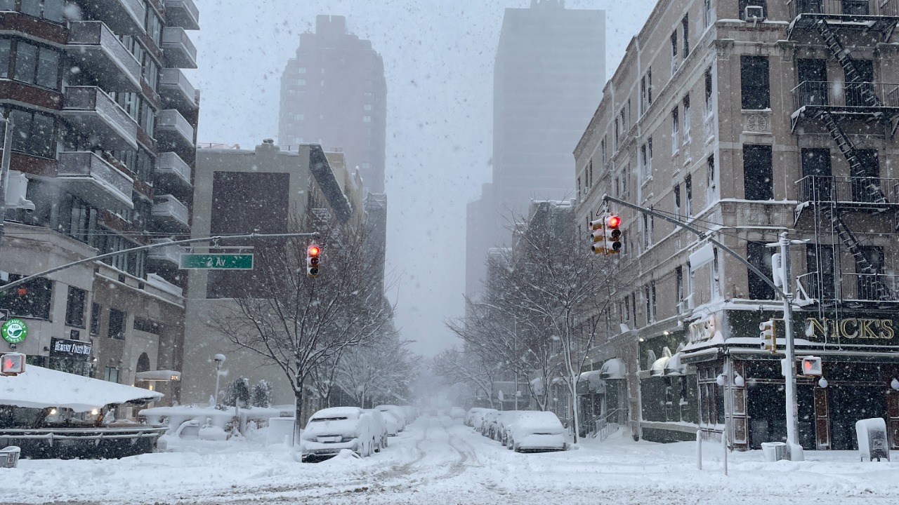
A powerful late-February blizzard brought much of the Northeast to a standstill, burying parts of Rhode Island under nearly 38 inches of snow, shutting airports, closing highways, and leaving hundreds of thousands without power.
What made the storm stand out was not only its reach, but how quickly it pushed many communities past what they were built to handle. The hardest-hit area was around Providence, where relentless bands of snow stalled long enough to turn an already dangerous storm into a record-breaker.
By the time the system pulled away, the totals had pushed the city into rare territory. Roads were impassable in places, transit systems were disrupted, and cleanup stretched well beyond the last snowfall.
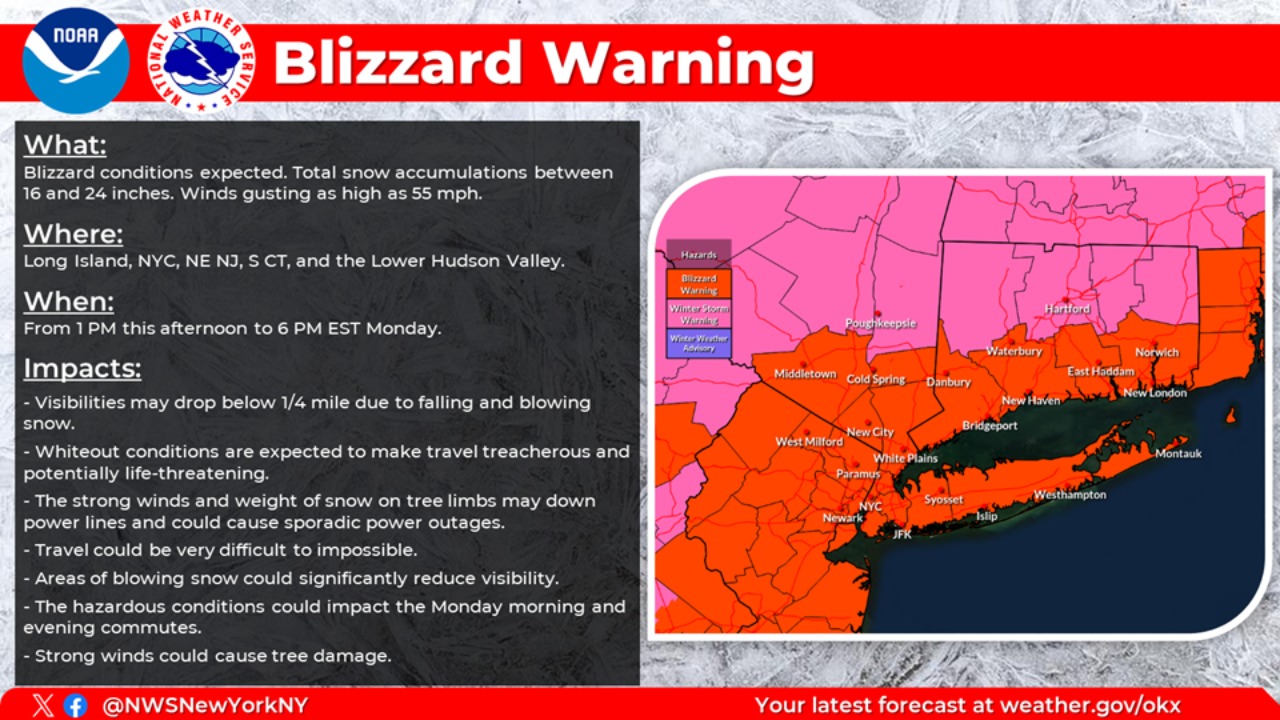
Federal climate officials later described the system as a historic bomb cyclone that delivered blizzard conditions, hurricane-force wind gusts, and heavy snow from the Mid-Atlantic into New England.
Providence Sets a Stunning Snowfall Mark

The Rhode Island T.F. Green International Airport reported the National Weather Service logged 37.9 inches of snow by the evening of Feb. 23. That total surpassed the previous benchmark set during the Blizzard of 1978, immediately placing this storm among the most significant snow events ever recorded in the state.
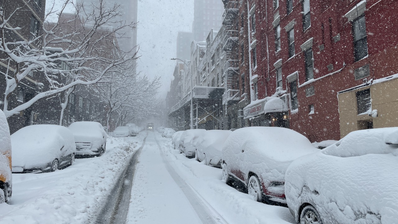
The same system produced extraordinary totals across nearby communities. The Weather Service reported 37.0 inches in Cranston, 36.1 inches in Providence, and 35.5 inches in Warren, underscoring how a concentrated corridor of extreme snowfall locked into place over Rhode Island and nearby southeastern Massachusetts.
In Bristol County, Massachusetts, totals climbed as high as 37.0 inches, showing that the storm’s most intense snow band did not stop at the state line.
That concentration mattered. This was not a broad, evenly distributed storm where snowfall totals were relatively uniform. Instead, it was a high-impact event defined by narrow but ferocious bands — the kind that can bury one metro area while locations not far away finish with significantly lower totals.
That dynamic is a key reason Providence ended up at the center of the story.
Why This Storm Was Different


Why This Storm Was Different
NOAA’s February 2026 national climate summary described the system as a historic bomb cyclone, meaning the storm intensified rapidly as it moved up the East Coast. That explosive deepening helped create the combination that makes major Northeast winter storms so disruptive: intense snowfall rates, strong winds and a massive population footprint.
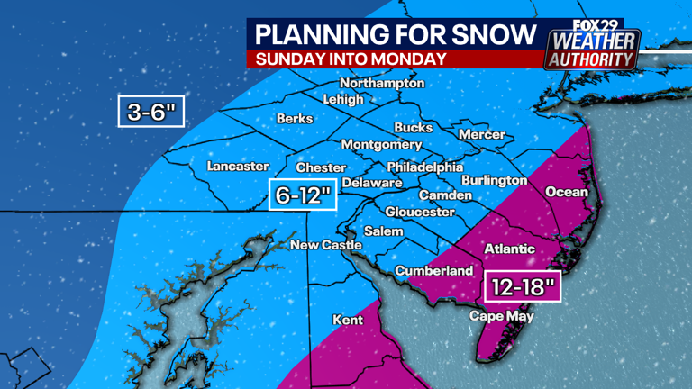
According to the National Oceanic and Atmospheric Administration, the storm affected more than 115 million people, with about 28 million receiving more than a foot of snow. The National Weather Service office in Mount Holly also documented significant totals farther south, including widespread accumulations in New Jersey and Delaware, where blizzard conditions were preliminarily confirmed in several coastal counties.
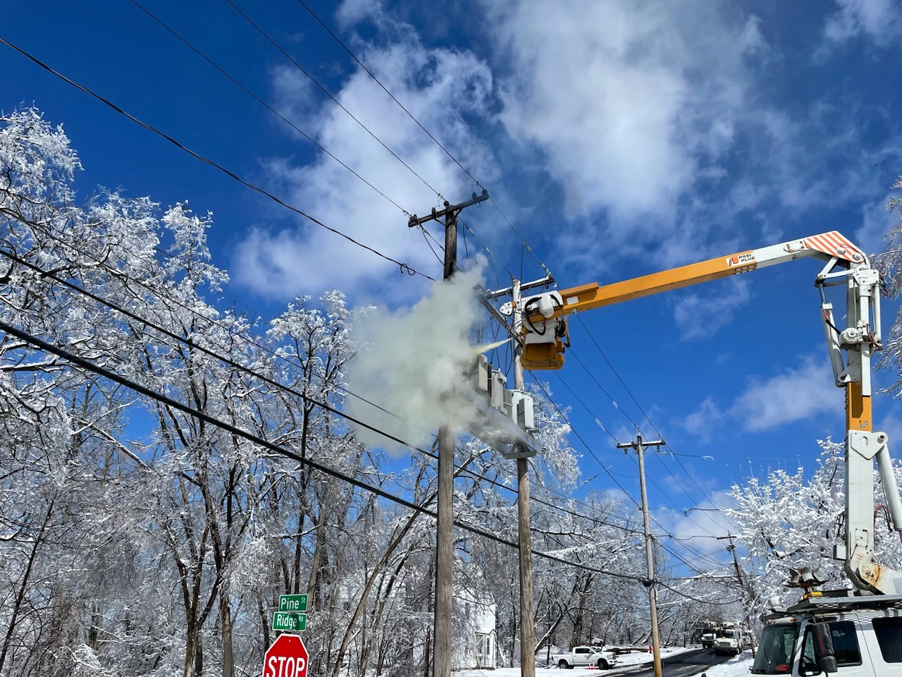
In practical terms, the storm combined the mechanics of a classic nor’easter with unusual intensity. It delivered crippling snow to some areas, severe blowing and drifting to others, and enough wind to worsen outages and slow recovery even after snowfall began to taper off.
The result was a storm defined not just by how much snow fell, but by how many different ways it disrupted daily life across a densely populated stretch of the country.
Emergency Orders and Travel Shutdowns

Rhode Island officials moved before conditions peaked. Dan McKee issued Executive Order 26-02 on Feb. 22, declaring a disaster emergency as blizzard warnings covered the state. The order activated emergency response resources and cleared the way for travel restrictions and National Guard support. An extension order followed the next day as impacts continued.
Those actions reflected the scale of what forecasters were seeing in real time. Once snowfall rates intensified, plows in the worst-hit corridors struggled to keep up. Restricting travel was less about symbolism than preserving road access for emergency vehicles and preventing stranded cars from making a dangerous situation worse.
The disruption spread well beyond roads. The Associated Press reported that Rhode Island T.F. Green International Airport temporarily halted operations, while major airports across the Northeast faced thousands of cancellations and delays. Public transit in several metro areas was also curtailed or suspended as the storm reached its peak.
A Regional Shutdown, Not Just a Snow Day
The blizzard’s reach is part of what makes it likely to be remembered long after this winter. Reuters reported that schools were closed across multiple states, roads were shut down and flight cancellations piled up as the storm moved north. Associated Press‘s follow-up coverage said Rhode Island’s 37.9-inch total was a preliminary state record and documented widespread outages and a difficult digging-out process across the region.
The storm was more than a local record event. A blizzard can post eye-catching snowfall numbers and still remain mostly a weather story. This one became an infrastructure story as well.
Airports paused, highways emptied, utility crews fanned out across multiple states and cities had to manage not only snow removal but what came after: blocked sidewalks, delayed commerce and neighborhoods cut off by towering piles of heavy snow.
Even after the skies cleared, recovery moved slowly. Deep accumulations narrowed residential streets, complicated parking, delayed school reopenings and forced local governments to shift resources toward plowing, hauling and public safety.
Travel ground to a halt across much of the Northeast. Major highways were effectively unusable at the height of the storm, while airports canceled thousands of flights as crews struggled with snow accumulation, limited visibility and deicing demands. Rail systems and commuter lines scaled back or suspended service entirely in some areas, cutting off another critical layer of regional mobility.
What the Blizzard Exposed


The most durable takeaway may be how thin the margin can be when an extreme storm lands over a dense, heavily traveled part of the Northeast. Forecasting gave officials warning, and emergency declarations helped. But nearly 38 inches of snow in the Providence area still overwhelmed ordinary operations.
That is why the late-February blizzard will be remembered for more than a snowfall statistic. Providence’s 37.9-inch total may become the number most people cite, but the bigger story is how a rapidly intensifying coastal storm managed to freeze a huge stretch of the Northeast at once.
It was a record-setting snowstorm. It was also a stark reminder of how quickly modern life can grind to a halt when weather pushes beyond the limits of routine winter planning.


